|
Unofficial Property Record Card - Falmouth, MA
|
|

|
|
General Property Data
|
|
|
| Parcel
ID |
33 13 014 000 |
Account
Number |
EAST FALMOUTH |
| Prior Parcel
ID |
-- |
| Property
Owner |
ROCKLAND TRUST COMPANY |
Property
Location |
397 EAST FALMOUTH HWY |
| |
|
Property
Use |
BANK |
| Mailing
Address |
288 UNION ST |
Most
Recent
Sale Date |
12/30/1997 |
| |
C/O FACILITIES DEPT |
Legal
Reference |
11142-0209 |
| City |
ROCKLAND |
Grantor |
SALAH JAMES M TR |
| Mailing
State |
|
Sale Price |
796,500 |
| ParcelZoning |
B2 |
Land Area |
0.750 acres |
|
|
|
|
|
Current Property Assessment
|
|
|
| Card 1 Value |
Building Value |
820,800 |
Xtra Features Value |
26,200 |
Land Value |
394,600 |
Total Value |
1,241,600 |
|
Total Parcel Value |
Building Value |
820,800 |
Xtra Features Value |
26,200 |
Land Value |
394,600 |
Total Value |
1,241,600 |
|
|
|
|
|
| Legal Description
|
|
|
|
|
|
|
| Narrative Description of Property
|
|
|
|
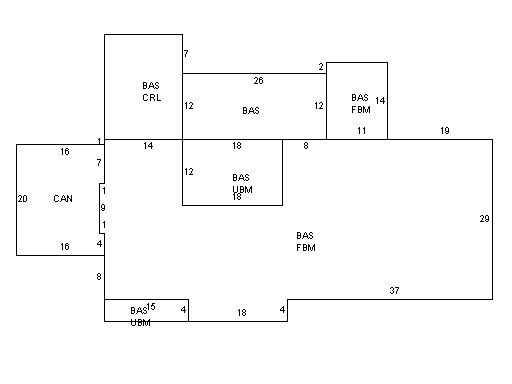
This property contains 0.750 acres of land mainly classified as
BANK
with a(n) Branch Bank style building, built about
1950 , having Clapboard exterior and Asphalt
roof cover, with 1
unit(s), 0
room(s), 0
bedroom(s), 0
bath(s), 2 half bath(s). |
|