|
Unofficial Property Record Card - Falmouth, MA
|
|

|
|
General Property Data
|
|
|
| Parcel
ID |
35 03 004 008 |
Account
Number |
WEST FALMOUTH |
| Prior Parcel
ID |
-- |
| Property
Owner |
COMMONWEALTH OF MASS |
Property
Location |
739 PALMER AVE |
| |
DMH |
Property
Use |
D M H |
| Mailing
Address |
1 ASHBURTON PL |
Most
Recent
Sale Date |
7/20/1989 |
| |
|
Legal
Reference |
06814-0168 |
| City |
BOSTON |
Grantor |
TEPPER SHIRLEY |
| Mailing
State |
|
Sale Price |
355,000 |
| ParcelZoning |
RB |
Land Area |
0.690 acres |
|
|
|
|
|
Current Property Assessment
|
|
|
| Card 1 Value |
Building Value |
512,400 |
Xtra Features Value |
0 |
Land Value |
292,100 |
Total Value |
804,500 |
|
Total Parcel Value |
Building Value |
512,400 |
Xtra Features Value |
0 |
Land Value |
292,100 |
Total Value |
804,500 |
|
|
|
|
|
|
Building Description
|
|
|
| Building
Style |
Colonial |
Foundation
Type |
Concrete |
Flooring
Type |
Carpet |
| # of Living
Units |
0 |
Frame
Type |
Wood |
Basement
Floor |
N/A |
| Year
Built |
1986 |
Roof
Structure |
Gable/Hip |
Heating
Type |
Hot Water |
| Building
Grade |
5 1.20 |
Roof
Cover |
Asphalt |
Heating
Fuel |
Oil |
| Building
Condition |
Average |
Siding |
Wood Shingle |
Air
Conditioning |
0% |
| Finished
Area (SF) |
3633 |
Interior
Walls |
Drywall |
# of Bsmt
Garages |
1 |
| Number
Rooms |
0 |
# of
Bedrooms |
0 |
# of Full
Baths |
4 |
| # of 3/4
Baths |
0 |
# of 1/2
Baths |
0 |
# of Other
Fixtures |
0 |
|
|
|
|
| Legal Description
|
|
|
|
|
|
|
| Narrative Description of Property
|
|
|
|
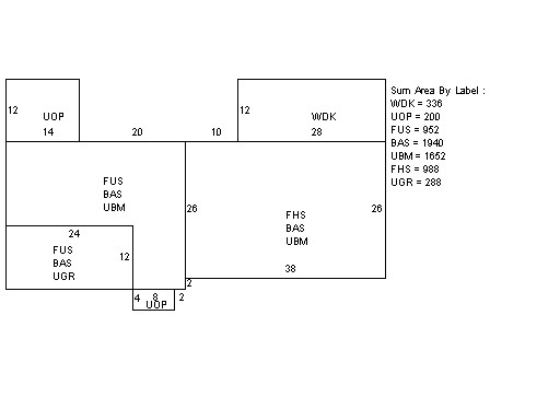
This property contains 0.690 acres of land mainly classified as
D M H
with a(n) Colonial style building, built about
1986 , having Wood Shingle exterior and Asphalt
roof cover, with 0
unit(s), 0
room(s), 0
bedroom(s), 4
bath(s), 0 half bath(s). |
|
|
|
| Property Images
|
|
|