|
Unofficial Property Record Card - Falmouth, MA
|
|

|
|
General Property Data
|
|
|
| Parcel
ID |
36 07 015 061 |
Account
Number |
WEST FALMOUTH |
| Prior Parcel
ID |
ROOF -- |
| Property
Owner |
PLISINSKI TRUSTEE PAUL J |
Property
Location |
17 MYRICK DR |
| |
PLISINSKI TRUSTEE MARGARET D |
Property
Use |
ONE FAMILY |
| Mailing
Address |
17 MYRICK DR |
Most
Recent
Sale Date |
7/13/2007 |
| |
|
Legal
Reference |
22184-213 |
| City |
FALMOUTH |
Grantor |
PLISINSKI,PAUL J |
| Mailing
State |
|
Sale Price |
1 |
| ParcelZoning |
RA |
Land Area |
1.143 acres |
|
|
|
|
|
Current Property Assessment
|
|
|
| Card 1 Value |
Building Value |
608,600 |
Xtra Features Value |
6,000 |
Land Value |
258,300 |
Total Value |
872,900 |
|
Total Parcel Value |
Building Value |
608,600 |
Xtra Features Value |
6,000 |
Land Value |
258,300 |
Total Value |
872,900 |
|
|
|
|
|
|
Building Description
|
|
|
| Building
Style |
Colonial |
Foundation
Type |
Concrete |
Flooring
Type |
Hardwood |
| # of Living
Units |
1 |
Frame
Type |
Wood |
Basement
Floor |
N/A |
| Year
Built |
1986 |
Roof
Structure |
Gable/Hip |
Heating
Type |
Frcd Hot Air |
| Building
Grade |
6 1.35 |
Roof
Cover |
WoodShingle |
Heating
Fuel |
Gas |
| Building
Condition |
Average |
Siding |
Brick Veneer |
Air
Conditioning |
100% |
| Finished
Area (SF) |
3061 |
Interior
Walls |
Drywall |
# of Bsmt
Garages |
0 |
| Number
Rooms |
8 |
# of
Bedrooms |
5 |
# of Full
Baths |
4 |
| # of 3/4
Baths |
0 |
# of 1/2
Baths |
1 |
# of Other
Fixtures |
0 |
|
|
|
|
| Legal Description
|
|
|
|
PLAN Y67 EYB=1988
|
|
|
| Narrative Description of Property
|
|
|
|
This property contains 1.143 acres of land mainly classified as
ONE FAMILY
with a(n) Colonial style building, built about
1986 , having Brick Veneer exterior and WoodShingle
roof cover, with 1
unit(s), 8
room(s), 5
bedroom(s), 4
bath(s), 1 half bath(s). |
|
|
|
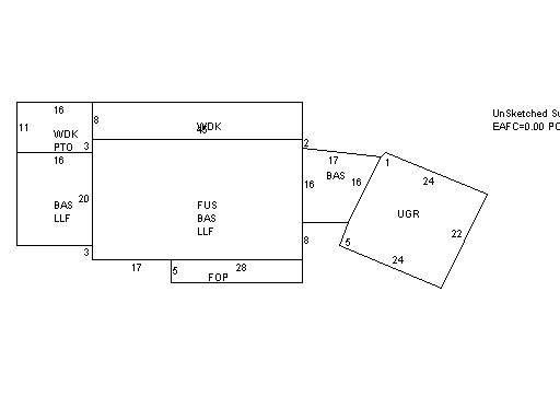
| Property Images
|
|
|