|
Unofficial Property Record Card - Falmouth, MA
|
|

|
|
General Property Data
|
|
|
| Parcel
ID |
47 07 010 002 |
Account
Number |
Falmouth |
| Prior Parcel
ID |
-- |
| Property
Owner |
MCINNIS TRUSTEE MICHAEL P |
Property
Location |
306 SURF DR |
| |
MCINNIS III TRUSTEE JAMES F |
Property
Use |
ONE FAMILY |
| Mailing
Address |
42 HUDSON ST |
Most
Recent
Sale Date |
6/10/2021 |
| |
|
Legal
Reference |
226583 |
| City |
FALMOUTH |
Grantor |
MCINNIS,JAMES F |
| Mailing
State |
|
Sale Price |
100 |
| ParcelZoning |
RB |
Land Area |
0.110 acres |
|
|
|
|
|
Current Property Assessment
|
|
|
| Card 1 Value |
Building Value |
128,700 |
Xtra Features Value |
0 |
Land Value |
470,600 |
Total Value |
599,300 |
|
Total Parcel Value |
Building Value |
128,700 |
Xtra Features Value |
0 |
Land Value |
470,600 |
Total Value |
599,300 |
|
|
|
|
|
|
Building Description
|
|
|
| Building
Style |
Bungalow |
Foundation
Type |
ABOVE FLOOD |
Flooring
Type |
Asph Tile |
| # of Living
Units |
1 |
Frame
Type |
Wood |
Basement
Floor |
N/A |
| Year
Built |
1955 |
Roof
Structure |
Gable/Hip |
Heating
Type |
None |
| Building
Grade |
6 1.35 |
Roof
Cover |
Asphalt |
Heating
Fuel |
NONE |
| Building
Condition |
Average |
Siding |
Wood Shingle |
Air
Conditioning |
0% |
| Finished
Area (SF) |
352 |
Interior
Walls |
SolidPanel |
# of Bsmt
Garages |
0 |
| Number
Rooms |
1 |
# of
Bedrooms |
0 |
# of Full
Baths |
0 |
| # of 3/4
Baths |
1 |
# of 1/2
Baths |
0 |
# of Other
Fixtures |
1 |
|
|
|
|
| Legal Description
|
|
|
|
|
|
|
| Narrative Description of Property
|
|
|
|
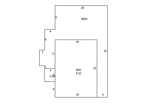
This property contains 0.110 acres of land mainly classified as
ONE FAMILY
with a(n) Bungalow style building, built about
1955 , having Wood Shingle exterior and Asphalt
roof cover, with 1
unit(s), 1
room(s), 0
bedroom(s), 0
bath(s), 0 half bath(s). |
|
|
|
| Property Images
|
|
|