|
Unofficial Property Record Card - Falmouth, MA
|
|

|
|
General Property Data
|
|
|
| Parcel
ID |
47B 06 014 000 |
Account
Number |
Falmouth |
| Prior Parcel
ID |
-- |
| Property
Owner |
363 MAIN STREET FALMOUTH LLC |
Property
Location |
100 KING ST |
| |
|
Property
Use |
APT 4-8 |
| Mailing
Address |
367 MAIN ST |
Most
Recent
Sale Date |
1/31/2014 |
| |
|
Legal
Reference |
27966-12 |
| City |
FALMOUTH |
Grantor |
LNT REALTY INVESTMENTS LLC, |
| Mailing
State |
|
Sale Price |
669,900 |
| ParcelZoning |
GR |
Land Area |
0.753 acres |
|
|
|
|
|
Current Property Assessment
|
|
|
| Card 1 Value |
Building Value |
305,000 |
Xtra Features Value |
0 |
Land Value |
374,800 |
Total Value |
679,800 |
|
Total Parcel Value |
Building Value |
422,500 |
Xtra Features Value |
20,600 |
Land Value |
374,800 |
Total Value |
817,900 |
|
|
|
|
|
|
Building Description
|
|
|
| Building
Style |
Family Conv |
Foundation
Type |
|
Flooring
Type |
Carpet |
| # of Living
Units |
3 |
Frame
Type |
Wood |
Basement
Floor |
N/A |
| Year
Built |
1900 |
Roof
Structure |
Gable/Hip |
Heating
Type |
Hot Water |
| Building
Grade |
4 1.1 |
Roof
Cover |
Asphalt |
Heating
Fuel |
Oil |
| Building
Condition |
Average |
Siding |
Vinyl Siding |
Air
Conditioning |
0% |
| Finished
Area (SF) |
2880 |
Interior
Walls |
Drywall |
# of Bsmt
Garages |
0 |
| Number
Rooms |
11 |
# of
Bedrooms |
5 |
# of Full
Baths |
4 |
| # of 3/4
Baths |
0 |
# of 1/2
Baths |
0 |
# of Other
Fixtures |
0 |
|
|
|
|
| Legal Description
|
|
|
|
BK 17135 PG 91 INCLUDES PAR 1 & 2
|
|
|
| Narrative Description of Property
|
|
|
|
This property contains 0.753 acres of land mainly classified as
APT 4-8
with a(n) Family Conv style building, built about
1900 , having Vinyl Siding exterior and Asphalt
roof cover, with 3
unit(s), 11
room(s), 5
bedroom(s), 4
bath(s), 0 half bath(s). |
|
|
|
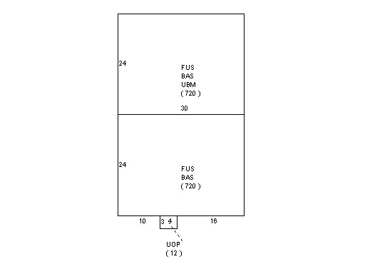
| Property Images
|
|
|