|
Unofficial Property Record Card - Falmouth, MA
|
|

|
|
General Property Data
|
|
|
| Parcel
ID |
48 13 011 030A |
Account
Number |
Falmouth |
| Prior Parcel
ID |
-- |
| Property
Owner |
MUNIER ROBERT S C |
Property
Location |
200 MOORLAND RD |
| |
MUNIER JAN C |
Property
Use |
ONE FAMILY |
| Mailing
Address |
200 MOORLAND RD |
Most
Recent
Sale Date |
12/15/2010 |
| |
|
Legal
Reference |
193198 |
| City |
FALMOUTH |
Grantor |
MCLEAN TRUSTEE,WALTER L |
| Mailing
State |
|
Sale Price |
1,086,000 |
| ParcelZoning |
RB |
Land Area |
0.712 acres |
|
|
|
|
|
Current Property Assessment
|
|
|
| Card 1 Value |
Building Value |
760,900 |
Xtra Features Value |
0 |
Land Value |
773,900 |
Total Value |
1,534,800 |
|
Total Parcel Value |
Building Value |
905,600 |
Xtra Features Value |
0 |
Land Value |
773,900 |
Total Value |
1,679,500 |
|
|
|
|
|
| Legal Description
|
|
|
|
|
|
|
| Narrative Description of Property
|
|
|
|
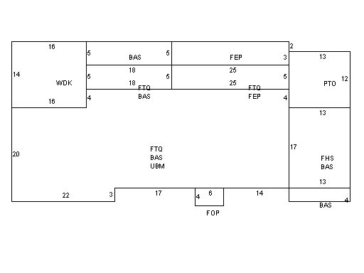
This property contains 0.712 acres of land mainly classified as
ONE FAMILY
with a(n) Colonial style building, built about
1925 , having Wood Shingle exterior and Asphalt
roof cover, with 1
unit(s), 10
room(s), 4
bedroom(s), 1
bath(s), 3 half bath(s). |
|