|
Unofficial Property Record Card - Falmouth, MA
|
|

|
|
General Property Data
|
|
|
| Parcel
ID |
48 13A 017 243 |
Account
Number |
Falmouth |
| Prior Parcel
ID |
-- |
| Property
Owner |
MOREY JOHN P |
Property
Location |
485 ELM RD |
| |
FOLLACO MOREY CARLA M |
Property
Use |
ONE FAMILY |
| Mailing
Address |
15 SMITH RD |
Most
Recent
Sale Date |
10/10/2013 |
| |
|
Legal
Reference |
201698 |
| City |
MILTON |
Grantor |
JAYE TRUSTEE,MICHAEL E |
| Mailing
State |
|
Sale Price |
2,600,000 |
| ParcelZoning |
RB |
Land Area |
1.758 acres |
|
|
|
|
|
Current Property Assessment
|
|
|
| Card 1 Value |
Building Value |
1,636,000 |
Xtra Features Value |
125,300 |
Land Value |
1,517,600 |
Total Value |
3,278,900 |
|
Total Parcel Value |
Building Value |
1,636,000 |
Xtra Features Value |
125,300 |
Land Value |
1,517,600 |
Total Value |
3,278,900 |
|
|
|
|
|
| Legal Description
|
|
|
|
|
|
|
| Narrative Description of Property
|
|
|
|
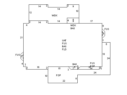
This property contains 1.758 acres of land mainly classified as
ONE FAMILY
with a(n) Conventional style building, built about
2010 , having Wood Shingle exterior and WoodShingle
roof cover, with 1
unit(s), 9
room(s), 4
bedroom(s), 2
bath(s), 1 half bath(s). |
|