|
Unofficial Property Record Card - Falmouth, MA
|
|

|
|
General Property Data
|
|
|
| Parcel
ID |
12 05 004 038 |
Account
Number |
NORTH FALMOUTH |
| Prior Parcel
ID |
-- |
| Property
Owner |
ZAX TRUSTEE MICHAEL ALAN |
Property
Location |
37 OLD FORGE RD |
| |
ZAX TRUSTEE SUSAN BRENDA |
Property
Use |
ONE FAMILY |
| Mailing
Address |
37 OLD FORGE RD |
Most
Recent
Sale Date |
10/29/2015 |
| |
|
Legal
Reference |
207787 |
| City |
NORTH FALMOUTH |
Grantor |
ZAX,MICHAEL A |
| Mailing
State |
|
Sale Price |
1 |
| ParcelZoning |
RB |
Land Area |
0.675 acres |
|
|
|
|
|
Current Property Assessment
|
|
|
| Card 1 Value |
Building Value |
669,400 |
Xtra Features Value |
1,700 |
Land Value |
344,700 |
Total Value |
1,015,800 |
|
Total Parcel Value |
Building Value |
669,400 |
Xtra Features Value |
1,700 |
Land Value |
344,700 |
Total Value |
1,015,800 |
|
|
|
|
|
| Legal Description
|
|
|
|
|
|
|
| Narrative Description of Property
|
|
|
|
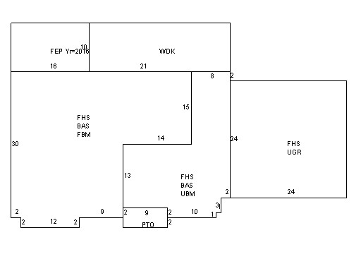
This property contains 0.675 acres of land mainly classified as
ONE FAMILY
with a(n) Cape Cod style building, built about
2002 , having Wood Shingle exterior and Asphalt
roof cover, with 1
unit(s), 8
room(s), 3
bedroom(s), 3
bath(s), 2 half bath(s). |
|