|
Unofficial Property Record Card - Falmouth, MA
|
|

|
|
General Property Data
|
|
|
| Parcel
ID |
02A 09 006 000 |
Account
Number |
NORTH FALMOUTH |
| Prior Parcel
ID |
-- |
| Property
Owner |
HARRINGTON JAMES D |
Property
Location |
19 OTIS ST |
| |
HARRINGTON MICHAEL W |
Property
Use |
ONE FAMILY |
| Mailing
Address |
100 BROOKSIDE AVE |
Most
Recent
Sale Date |
6/3/2004 |
| |
|
Legal
Reference |
173261 |
| City |
BELMONT |
Grantor |
HARRINGTON,JAMES D |
| Mailing
State |
|
Sale Price |
0 |
| ParcelZoning |
RB |
Land Area |
0.223 acres |
|
|
|
|
|
Current Property Assessment
|
|
|
| Card 1 Value |
Building Value |
249,000 |
Xtra Features Value |
2,700 |
Land Value |
357,200 |
Total Value |
608,900 |
|
Total Parcel Value |
Building Value |
249,000 |
Xtra Features Value |
2,700 |
Land Value |
357,200 |
Total Value |
608,900 |
|
|
|
|
|
|
Building Description
|
|
|
| Building
Style |
Raised Ranch |
Foundation
Type |
|
Flooring
Type |
Carpet |
| # of Living
Units |
1 |
Frame
Type |
Wood |
Basement
Floor |
N/A |
| Year
Built |
1968 |
Roof
Structure |
Gable/Hip |
Heating
Type |
Frcd Hot Air |
| Building
Grade |
4 1.1 |
Roof
Cover |
Asphalt |
Heating
Fuel |
Gas |
| Building
Condition |
Average |
Siding |
Wood Shingle |
Air
Conditioning |
100% |
| Finished
Area (SF) |
1236 |
Interior
Walls |
Drywall |
# of Bsmt
Garages |
0 |
| Number
Rooms |
8 |
# of
Bedrooms |
5 |
# of Full
Baths |
1 |
| # of 3/4
Baths |
0 |
# of 1/2
Baths |
1 |
# of Other
Fixtures |
0 |
|
|
|
|
| Legal Description
|
|
|
|
|
|
|
| Narrative Description of Property
|
|
|
|
This property contains 0.223 acres of land mainly classified as
ONE FAMILY
with a(n) Raised Ranch style building, built about
1968 , having Wood Shingle exterior and Asphalt
roof cover, with 1
unit(s), 8
room(s), 5
bedroom(s), 1
bath(s), 1 half bath(s). |
|
|
|
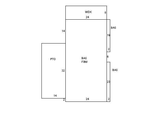
| Property Images
|
|
|