|
Unofficial Property Record Card - Falmouth, MA
|
|

|
|
General Property Data
|
|
|
| Parcel
ID |
14 06 003 150 |
Account
Number |
WEST FALMOUTH |
| Prior Parcel
ID |
-- |
| Property
Owner |
KNOWLES MICHAEL G |
Property
Location |
30 NAUSHON CIR |
| |
KNOWLES SUSAN H |
Property
Use |
ONE FAMILY |
| Mailing
Address |
30 NAUSHON CIR |
Most
Recent
Sale Date |
6/25/1999 |
| |
|
Legal
Reference |
153712 |
| City |
FALMOUTH |
Grantor |
GOOD STEPHEN M TR |
| Mailing
State |
|
Sale Price |
450,000 |
| ParcelZoning |
RB |
Land Area |
0.629 acres |
|
|
|
|
|
Current Property Assessment
|
|
|
| Card 1 Value |
Building Value |
977,500 |
Xtra Features Value |
0 |
Land Value |
1,423,700 |
Total Value |
2,401,200 |
|
Total Parcel Value |
Building Value |
977,500 |
Xtra Features Value |
0 |
Land Value |
1,423,700 |
Total Value |
2,401,200 |
|
|
|
|
|
| Legal Description
|
|
|
|
|
|
|
| Narrative Description of Property
|
|
|
|
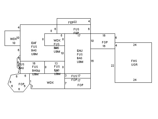
This property contains 0.629 acres of land mainly classified as
ONE FAMILY
with a(n) Colonial style building, built about
2000 , having Wood Shingle exterior and Asphalt
roof cover, with 1
unit(s), 7
room(s), 4
bedroom(s), 3
bath(s), 0 half bath(s). |
|