|
Unofficial Property Record Card - Pembroke, MA
|
|

|
|
General Property Data
|
|
|
| Parcel
ID |
B2-489 |
Account
Number |
0 |
| Prior Parcel
ID |
B2-490,566-- |
| Property
Owner |
DEACETIS STEVEN D. |
Property
Location |
12 BARTLETT STREET |
| |
|
Property
Use |
ONE FAM |
| Mailing
Address |
12 BARTLETT STREET |
Most
Recent
Sale Date |
2/2/1989 |
| |
|
Legal
Reference |
8971-131 |
| City |
PEMBROKE |
Grantor |
|
| Mailing
State |
|
Sale Price |
124,900 |
| ParcelZoning |
|
Land Area |
0.220 acres |
|
|
|
|
|
Current Property Assessment
|
|
|
| Card 1 Value |
Building Value |
149,900 |
Xtra Features Value |
3,400 |
Land Value |
222,900 |
Total Value |
376,200 |
|
Total Parcel Value |
Building Value |
149,900 |
Xtra Features Value |
3,400 |
Land Value |
222,900 |
Total Value |
376,200 |
|
|
|
|
|
|
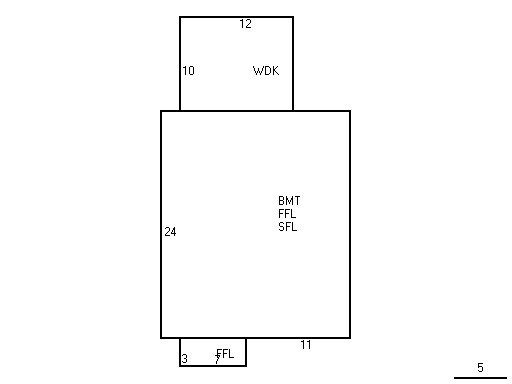
Building Description
|
|
|
| Building
Style |
COLONIAL |
Foundation
Type |
CONCRETE |
Flooring
Type |
AVERAGE |
| # of Living
Units |
1 |
Frame
Type |
WOOD |
Basement
Floor |
N/A |
| Year
Built |
1988 |
Roof
Structure |
GABLE |
Heating
Type |
FORCED H/W |
| Building
Grade |
AVERAGE |
Roof
Cover |
ASPHALT |
Heating
Fuel |
OIL |
| Building
Condition |
Good |
Siding |
WOOD SHING |
Air
Conditioning |
0% |
| Finished
Area (SF) |
981 |
Interior
Walls |
DRYWALL |
# of Bsmt
Garages |
0 |
| Number
Rooms |
5 |
# of
Bedrooms |
2 |
# of Full
Baths |
1 |
| # of 3/4
Baths |
0 |
# of 1/2
Baths |
0 |
# of Other
Fixtures |
1 |
|
|
|
|
| Legal Description
|
|
|
|
|
|
|
| Narrative Description of Property
|
|
|
|
This property contains 0.220 acres of land mainly classified as
ONE FAM
with a(n) COLONIAL style building, built about
1988 , having WOOD SHING exterior and ASPHALT
roof cover, with 1
unit(s), 5
room(s), 2
bedroom(s), 1
bath(s), 0 half bath(s). |
|
|
|
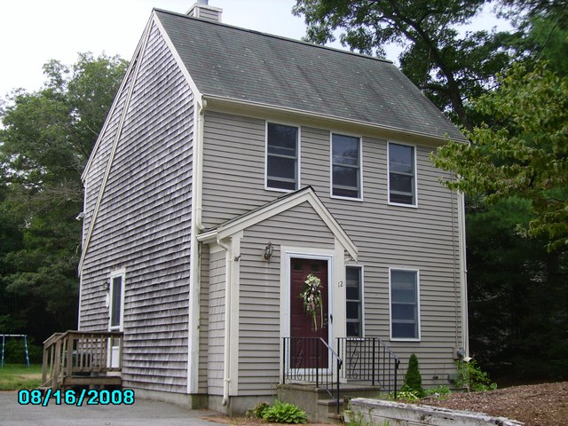
| Property Images
|
|
|